This is fast emerging as a critical issue for billions of people. As part of its week-long series on the topic, Carbon Brief hosted a free webinar (video below) on whether it is likely to be the defining issue at the next round of UN climate talks, COP27.
But as our research published today in Nature Communications has found, some oceans work harder than others.
We used a computational global ocean circulation model to examine exactly how ocean warming has played out over the last 50 years. And we found the Southern Ocean has dominated the global absorption of heat. In fact, Southern Ocean heat uptake accounts for almost all the planet’s ocean warming, thereby controlling the rate of climate change.
This Southern Ocean warming and its associated impacts are effectively irreversible on human time scales, because it takes millennia for heat trapped deep in the ocean to be released back into the atmosphere.
This means changes happening now will be felt for generations to come – and those changes are only set to get worse, unless we can stop carbon dioxide emissions and achieve net zero.
It’s important yet difficult to measure ocean heating
Ocean warming buffers the worst impacts of climate change, but it’s not without cost. Sea levels are rising because heat causes water to expand and ice to melt. Marine ecosystems are experiencing unprecedented heat stress, and the frequency and intensity of extreme weather events is changing.
Yet, we still don’t know enough about exactly when, where and how ocean warming occurs. This is because of three factors.
First, temperature changes at the ocean surface and in the atmosphere just above track each other closely. This makes it difficult to know exactly where excess heat is entering the ocean.
Second, we don’t have measurements tracking temperatures over all of the ocean. In particular, we have very sparse observations in the deep ocean, in remote locations around Antarctica and under sea ice.
Last, the observations we do have don’t go back very far in time. Reliable data from deeper than 700 metres depth is virtually non-existent prior to the 1990s, apart from observations along specific research cruise tracks.
Earth’s heat inventory since 1960 (ZJ = 10²¹ J). Credit: von Schuckmann et al. (2020).
Our modelling approach
To work out the intricacies of how ocean warming has played out, we first ran an ocean model with atmospheric conditions perpetually stuck in the 1960s, prior to any significant human-caused climate change.
Then, we separately allowed each ocean basin to move forward in time and experience climate change, while all other basins were held back to experience the climate of the 1960s.
We also separated out the effects of atmospheric warming from surface wind-driven changes to see how much each factor contributes to the observed ocean warming.
By taking this modelling approach, we could isolate that the Southern Ocean is the most important absorber of this heat, despite only covering about 15% of the total ocean’s surface area.
In fact, the Southern Ocean alone could account for virtually all global ocean heat uptake, with the Pacific and Atlantic basins losing any heat gained back into the atmosphere.
One significant ecological impact of strong Southern Ocean warming is on Antarctic krill. When ocean warming occurs beyond temperatures they can tolerate, the krill’s habitat contracts and they move even further south to cooler waters.
As krill is a key component of the food web, this will also change the distribution and population of larger predators, such as commercially viable tooth and ice fish. It will also further increase stress for penguins and whales already under threat today.
So why is the Southern Ocean absorbing so much heat?
This largely comes down to the geographic set-up of the region, with strong westerly winds surrounding Antarctica exerting their influence over an ocean that’s uninterrupted by land masses.
This means the Southern Ocean winds blow over a vast distance, continuously bringing masses of cold water to the surface. The cold water is pushed northward, readily absorbing vast quantities of heat from the warmer atmosphere, before the excess heat is pumped into the ocean’s interior around 45-55°S (a latitude band just south of Tasmania, New Zealand, and the southern regions of South America).
This warming uptake is facilitated by both the warmer atmosphere caused by our greenhouse gas emissions, as well as wind-driven circulation which is important for getting heat into the ocean interior.
And when we combine the warming and wind effects only over the Southern Ocean, with the remaining oceans held back to the climate of the 1960s, we can explain almost all of the global ocean heat uptake.
But that’s not to say the other ocean basins aren’t warming. They are, it’s just that the heat they gain locally from the atmosphere cannot account for this warming. Instead, the massive heat uptake in the Southern Ocean is what has driven changes in total ocean heat content worldwide over the past half century.
We have much to learn
While this discovery sheds new light on the Southern Ocean as a key driver of global ocean warming, we still have a lot to learn, particularly about ocean warming beyond the 50 years we highlight in our study. All future projections, including even the most optimistic scenarios, predict an even warmer ocean in future.
And if the Southern Ocean continues to account for the vast majority of ocean heat uptake until 2100, we might see its heat content increase by as much as seven times more than what we have already seen up to today.
To capture all of these changes, it’s vital we continue and expand our observations taken in the Southern Ocean.
One of the most important new data streams will be new ocean floats that can measure deeper ocean temperatures, as well as small temperature sensors on elephant seals, which give us essential data of oceanic conditions in winter under Antarctic sea ice.
Even more important is the recognition that the less carbon dioxide we emit, the less ocean change we will lock in. This will ultimately limit the disruption of livelihoods for the billions of people living near the coast worldwide.
There is a new risk to you – the taxpayer – from the government’s recent decision to back off from excluding exotic species like pine from the permanent forest category of the emissions trading scheme.
From 1 January 2023 forest owners can lock up pine plantations, as ‘permanent forests’. In return, while the trees are growing, owners will be able to earn credits which they can sell to polluting industries to offset emissions. When the trees stop growing those revenue streams finish. This means pine plantations will increasingly be planted with no intent to harvest. A new exotic carbon farming industry will rapidly spread across the land–an industry we can think of as carbon mining.
Just like its traditional format, carbon mining is an extractive industry. Once there is no resource left–in this case, when the pine trees stop growing–the mine is of no value and becomes a liability.
In addition to the long-term costs of managing a plantation in its ‘permanent’ state, any deforestation requires the owners to buy emission units. There is a very real risk of a ticking time bomb with the price of emissions units increasing significantly over time.
Pinus radiata is an introduced species, unlike native forests with diversity and climate resilience. With increasing impacts from climate change, pine plantations present heightened risks.
They burn well, creating risks for neighbours and releasing CO2 back into the atmosphere. The recent wildfires in the Landes forest, the largest planted forest in western Europe, saw thousands of hectares burnt and thousands of people evacuated.
These are monocultures, at a time when a biodiversity crisis and collapsing ecosystems are posing risks to human survival. In NZ, they are also monoclones, with a lack of genetic diversity that makes them very vulnerable to climate change. In many parts of the world, pests and diseases are wiping out huge areas of pine plantations.
Pinus radiata is also a relatively short-lived species, especially in New Zealand due to intensive genetic modification. Compared with native forests, pine plantations sequester carbon for a relatively brief period. As the trees age and die, the risks of fire and disease increase, along with the risks that the plantations will be abandoned.
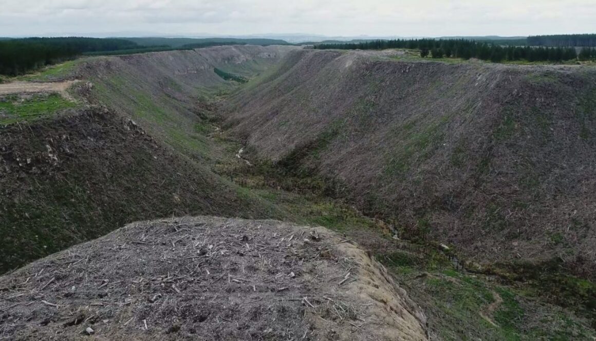
Promises may be made that instead, pine plantations will be converted to native forests. This is a very difficult and high risk process, however. Take for example Maungataniwha pine plantation.
It can take at least a decade to clear logged land of wilding pines and to get it to the point where it can be described as fully regenerated – supposing you are lucky enough to have native seeds in the soil already. It’s costing the Forest Lifeforce Restoration Trust around $70,000 per year, plus a lot of volunteer hours.
If land owners are not inclined or able to meet their obligations, these sorts of projects will be extremely challenging. Government and communities will pick up the costs of remediation.
Millions more would be needed to pay for the purchase of emission units to offset the felled pine, and it is hard to see where this money would come from.
As designed, the ETS is encouraging the misallocation of capital towards carbon mining, with the potential for damaging long-term socio-economic and biodiversity outcomes.
Ultimately, taxpayers and society will be left with the bill. The environment will suffer, biodiversity will be negatively impacted, resilience to climate change will be reduced and you, me, our children will be picking up the bill.
“In a landmark decision, a United Nations committee on Friday found Australia’s former Coalition government violated the human rights of Torres Strait Islanders by failing to adequately respond to the climate crisis.”
This decision sets a precedent that has direct implications for Aoteora. For the first time:
“Significantly, deep Indigenous cultural and ecological knowledge, rather than Western climate science, proved key to this UN decision. This marks a departure from broad international climate politics where Indigenous laws, cultures, knowledges and practices are often sidelined or underrepresented.”
“The Torres Strait Islanders ‘Group of Eight’ claimed Australia failed to take measures such as reducing greenhouse gas emissions and upgrading seawalls on the islands. The UN upheld the complaint and said the claimants should be compensated.
“This decision is a breakthrough in Indigenous rights and climate justice, including by opening up new pathways for Indigenous communities – who are often on the frontline of the climate crisis – to defend their rights.
“The Albanese government, which has stated its commitment to work with the Torres Strait on climate change, must now meet this moment of possibility and challenge.
October 31: that’s the date for the United Nations Climate Change Conference in Glasgow, COP26. It’s now clear that the Paris target to limit temperatures to 1.5 degrees has failed. Meeting these targets set by governments, including New Zealand, would result in warming well above 3 degrees by 2100.
“We are facing the twin threats of climate change and biodiversity loss. One cannot be solved without addressing the other…. Yet only 3% of global climate finance is spent on nature-based solutions, and only 1% for adaptation.”
One of the three key goals of COP26 is to:
“Protect and restore nature for the benefit of people and climate” and to “call on governments, businesses and civil society to endorse the Leaders’ Pledge for Nature and make ambitious commitments to build nature positive economies and societies.”
In support of this goal, every day from 01 September until October 31, we’ll be posting an extract from this website on Facebook.
By definition, braided rivers are made up of multiple channels or ‘braids’. Systematically forcing them into the solitary confinement of single channels is turning them into what University of Waikato’s Professor James Brasington calls “zombie” rivers, waterways locked into position between stopbanks and their headwaters. Planting willows and poplars as a ‘natural’ way to hold them in place has just exacerbated the problem. Confining braided rivers not only creates problems for freshwater ecosystems including habitat for braided river birds, it also makes these rivers prone to catastrophic flooding.
“If we put our rivers into straight-jackets, they lose the diversity of form and process that are fundamental to the creation of thriving ecosystems. Instead, we should make space for rivers to erode their corridors, flood naturally in areas that are of less value which will in turn, reduce risks in more sensitive areas. We must work with natural processes to reduce the flood risk and support healthy river ecosystems.” – James Brassington
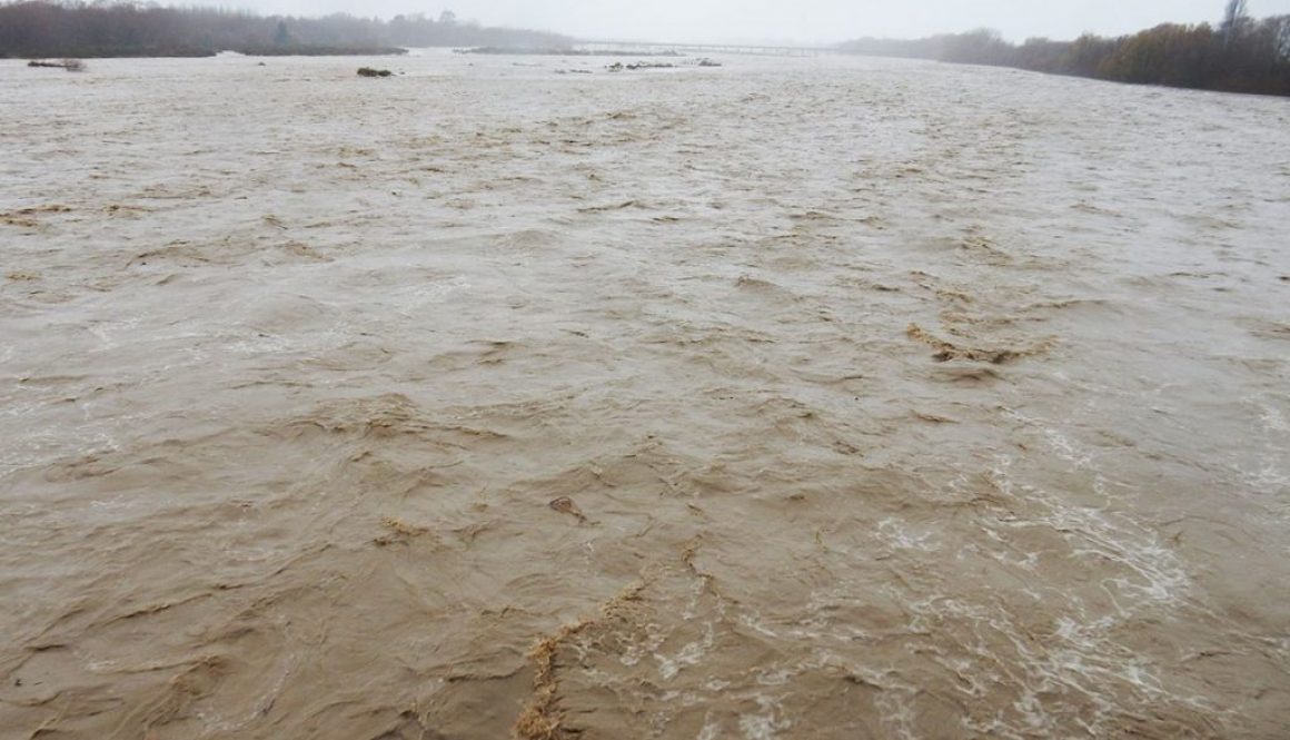
Last weekend, several zombie rivers in Canterbury broke free and invaded towns and properties.
It’s not like we weren’t warned. In 2019, NIWA published this extraordinarily well-ignored report outlining the current NZ$40 billion flood risks to Canterbury (no, that’s no a misprint; it’s billion, not million) (Fig. 2) .
Fig. 2: From 2019 NIWA’s 2019 report, ‘New Zealand Fluvial and Pluvial Flood Exposure’ (page 8). Exposure to flood risk does not mean all of the areas on the map (click the image) will flood. However, the risks are increasing as the climate changes as warmer air carries more moisture.
I’ve yet to meet anyone who read their entire report, much less acted on it. A small extract made headline news in a North Canterbury paper and was promptly forgotten.
Two weeks ago, I gave a presentation to the Waimakariri drainage group on the risks of flooding from pluvial and fluvial events and rising sea levels. It caused some discomfort, but then again, I was talking about climate change. A concept that probably seemed too remote to lose much sleep over.
Last weekend’s floods will no doubt make headline news again in our local papers. And in a few weeks it will also probably be forgotten by most people, especially those who weren’t directly affected. Part of the reason is that the phrase ‘1-in-100 event’ is often misunderstood, leading to a false sense of security that these zombies and their big brother rivers are unlikely to escape again in our lifetimes. (The term ‘1-in-100 years’ is in fact a statistical annual exceedance probability. It’s arguably moot in any case as many hydrologists consider stationarity to be dead.)
And then there’s the false perception that ECan is obligated to shove every metre of rivers back into solitary confinement. The situation on the Okuku River is a case in point. The poor little Okuku, like many zombie rivers, is so glutted with weeds that it’s unrecognisable as a braided river. It’s not even mentioned on the braided rivers website. I mention it here now, because this section of the Okuku is outside the river ratings area. Councils are under no obligation to protect those who live and farm in its riverbed. At some point, properties in riverbeds are likely to be deemed too risky to insure, which raises the question of who will pay for more extreme weather events? And how can we tell if climate change is the cause?
“We shouldn’t be surprised when our rivers break their banks — that’s just a river being a river. Current management practices in Aotearoa treat rivers as static, in the hope of making them more predictable.
“But this can lead to disasters.
“Unless we change management practices to work with a river, giving it space to move and allowing channels to adjust, we will continue to put people and rivers on a collision course.
“When flood risk is managed poorly, disadvantaged groups of the population are often disproportionately impacted. Given climate change predictions of more extreme floods and drought, the problem will only get worse.”
One of the authors of this article, Dr Jo Hoyle from NIWA, will be presenting a paper at the next Braided Rivers seminar at Lincoln University Wednesday 14 July. If you are reading this after the event, a PDF of her presentation will be available here.
For more information see the pages on this website: